Wintry mix, icy conditions possible for parts of North Texas this week
DALLAS - Parts of North Texas could see a wintry mix this week as rain enters the forecast Monday, before arctic air makes its way into the Metroplex Wednesday.
The week begins Spring-like, with stronger storms possible Monday night ahead of a cold front.
While those storms are not expected to be severe, a few may be strong with gusty winds and small hail possible during those Monday storms.
There's another blast of winter behind the front, with temperatures dropping close to freezing Wednesday.
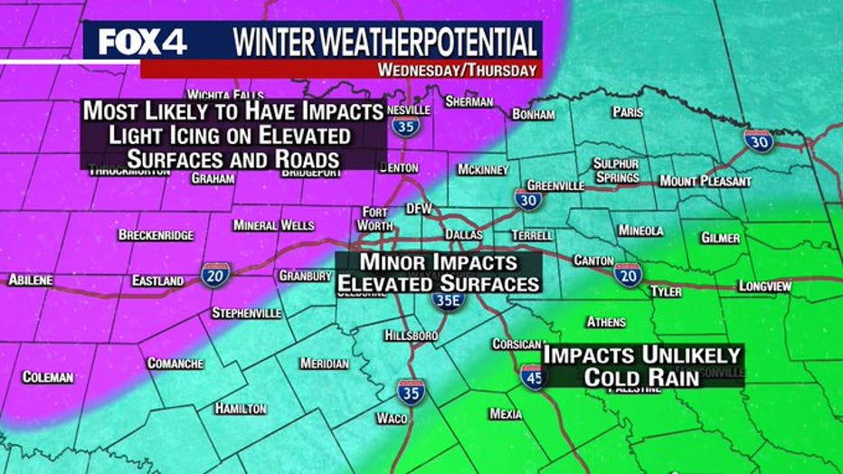
As arctic air returns, another disturbance brings a cold rain and potentially icy conditions to North Texas mid-week.
At this point, the greatest risk for freezing rain and sleet exists just northwest of the Metroplex. This area has the highest likelihood of icy conditions on elevated surfaces and roads.
Around the Metroplex, temperatures may hover close to freezing and a temperature swing of just a couple of degrees could change the forecast drastically, from cold rain to freezing rain.
As you head southeast, temperatures stay above freezing, likely keeping all precipitation a very cold rain.
MORE: FOX 4 Weather Coverage