

Dallas weather: More hail, storms possible Monday, Tuesday

Dallas weather: June 12 evening forecast
A Tornado Watch has been issued for parts of North Texas on Monday night. FOX 4's Dan Henry takes a look at where and when the storms are most likely to hit, plus a look at the heat coming this weekend.
After last night's hail and damaging winds North Texas could be in for another round of severe weather.
A Tornado Watch was issued for the far southwest parts of North Texas until 10 p.m.
For much of the morning and afternoon things will be calm, with temperatures not quite as high on Monday as they were on Sunday.
Things start to pick up to the west around 4 p.m. with the main risks in the Metroplex being from 5 to 6 p.m. to midnight.
Large hail is unusual for North Texas in June. Here's why
The biggest risk for large hail is to the south and west where it is going to be hotter. There is a chance of an isolated tornado in area, but the main threat will be hail.
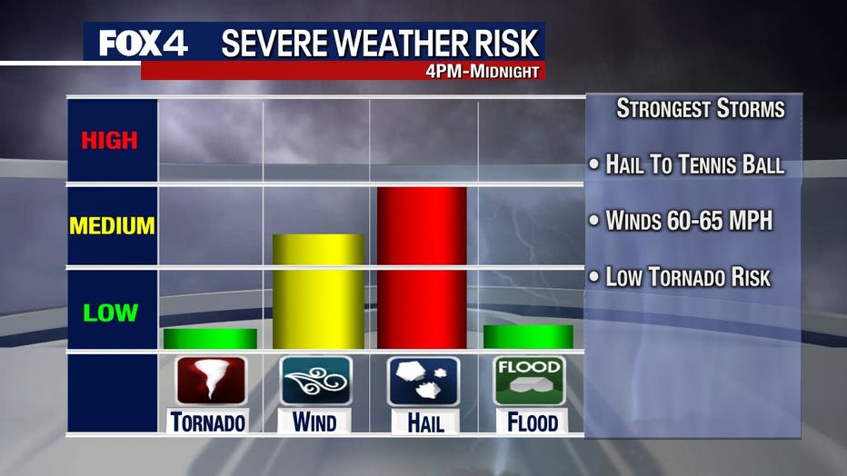
The coverage for storms on Monday is about 40%, meaning it is possible more than half of people in our area don't see a drop.
Tuesday will have a similar set-up for severe storms with the risk for storms from the Metroplex on to the east. At this point, coverage is expected to be about 30% on Tuesday.

Hail the size of baseballs pounds North Texas Sunday night
Severe storms brought large hail, caused power outages, and delayed flights in North Texas. Some people reported hail as large as softballs.
7-Day Forecast
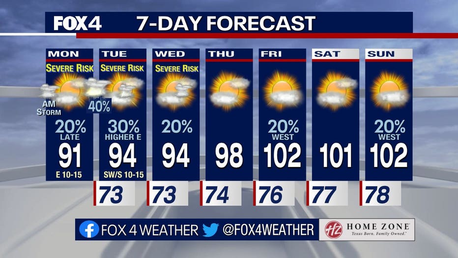
After the storms the next big thing to watch will be the temperatures. They are expected to spike going into the weekend.
Friday, Saturday and Sunday could be our first 3 triple-digit days of the year.