Dallas weather: Line of storms moves across North Texas Wednesday morning
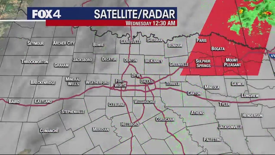
More storms moved through North Texas overnight and early Wednesday morning.
The storms blew up around 3:30 a.m. and brought heavy rain, lightning, and a bit of hail in the Dallas-Fort Worth area.
But they arrived a little later than expected and that made a difference. People in the Fort Worth area didn't see much and those in the Dallas area were mostly spared from anything severe.
READ MORE: Tornadoes in Arkansas, Midwest kill at least 21 people

Dallas Weather: April 5 morning forecast
FOX 4 Weather meteorologist Evan Andrews says the storms have moved through the metroplex. Behind them is cooler and dryer weather.
The storms have since moved east of the metroplex.
A Tornado Watch was issued for the far northeast part of North Texas until noon. That watch no longer includes counties in the FOX 4 viewing area.

After the storms move out of the area the rest of the day will be dry.
Temperatures will dip into the high 50s before things warm up again later in the day.
Live Updates
7-Day Forecast
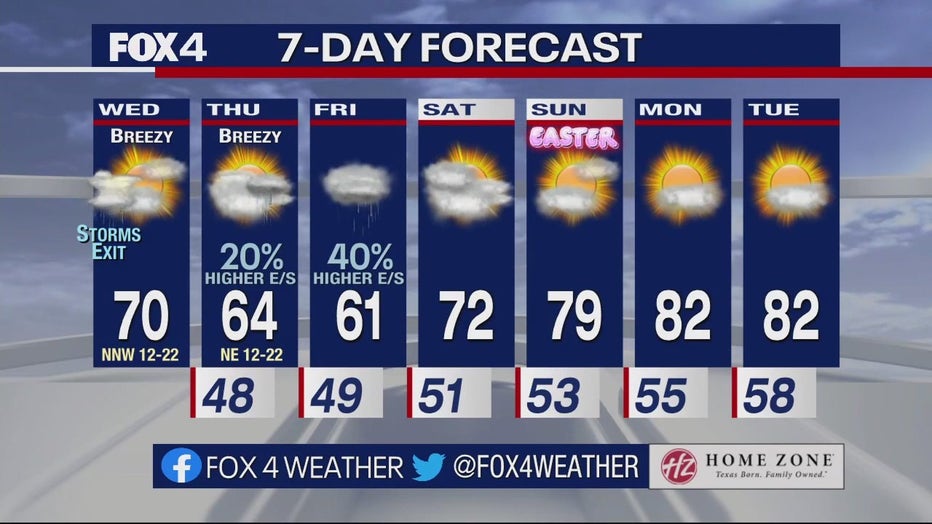
After things dry out on Wednesday, there is a chance of rain on Friday and Saturday.
READ MORE: Tornado-spawning storms could get worse as world warms, study finds
High temperatures are expected to be in the 60s and low 70s for most of the week.

Easter Forecast
Easter Sunday is looking good for all of your egg hunts and activities.
There is a high temperature of 79 degrees on Sunday with partly cloudy skies.

