

Dallas weather: Cooler temperatures, shot of rain this weekend
Dallas weather: August 31 morning forecast
FOX 4 meteorologist Ali Turiano takes a look at the rain chances this Labor Day weekend.
This holiday weekend will come with cooler weather, clouds and even a shot at rain.
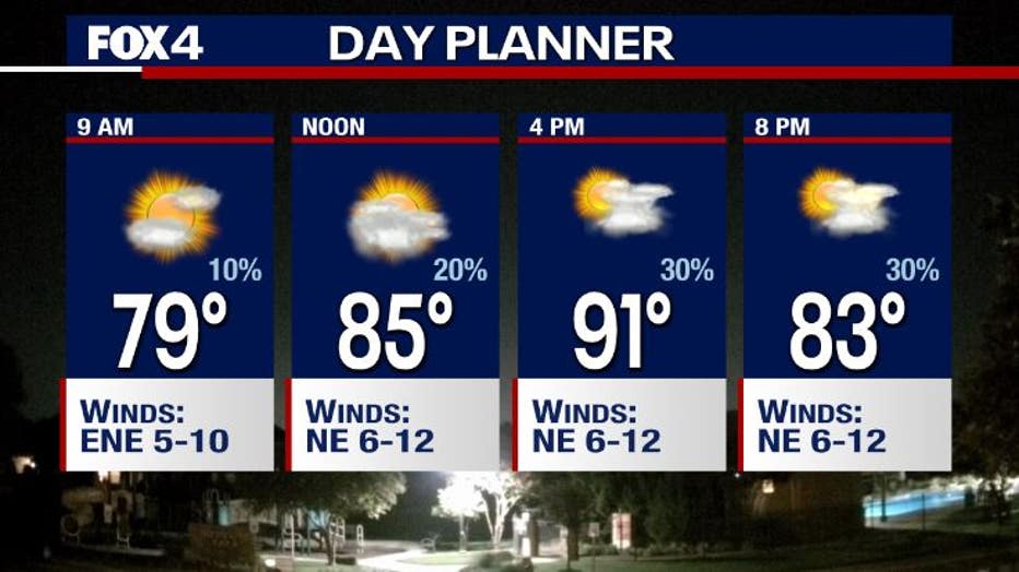
Saturday Forecast
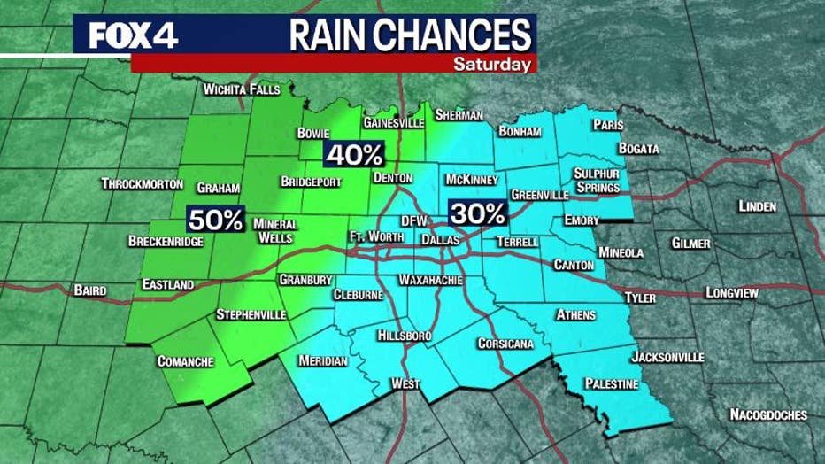
A stalled front has parked itself over the Metroplex increasing our shot at rain, but your shot to see it will depend a lot on where you live.
On Saturday, rain chances are higher on the cooler side of the front from DFW to the west. The highest chances of rain will be in the midday to later hours of the day. Rain chances for people to the west are about 30-40%.
From Dallas east the chances are lower. We'll put the shot at rain there around 20% until you get all the way into east Texas where chances will be higher.
High temperatures are in the low 90s from DFW to the east and will top out in the high 80s to the west.
Even though are temperatures will be lower this weekend, the humidity will still be around what we've seen recently.
Sunday Forecast
Sunday's forecast is pretty similar, with the front moving a bit farther to the south and east.
Most of us will see higher cloud cover with a slightly higher shot at rain.
Areas to the south and east of Dallas will see fewer showers and temperatures in the low 90s.
The position of the front will determine who gets what.
Monday Forecast
On Monday, a low pressure area will develop in west Texas, which will keep things cloudy.
High temperatures will be in the 80s for most in our area.
Rain chances sit around 40%.
7-Day Forecast

Tuesday things will get wetter and the temperatures will get cooler.
The low pressure area will move into our direction and rain chances will jump.
There will be thicker cloud cover on Tuesday.
We have a shot at seeing storms on Wednesday as well.
One thing you can see in this 7-day forecast, a lot of temperatures in the upper 80s!
This September is getting off to a cool start.