Tropical Storm Sara expected to dissipate over Mexico or Bay of Campeche
Tropical Storm Sara forms in the Caribbean
FOX 13 meteorologist Nash Rhodes has the latest track for Tropical Storm Sara.
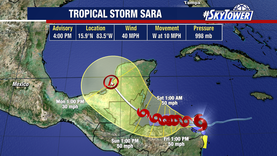
TAMPA, Fla. - Tropical Storm Sara formed in the Caribbean Sea on Thursday, but the National Hurricane Center says there's a chance it won't reach hurricane strength.
In fact, the NHC says Sara is expected to dissipate over Mexico or the Bay of Campeche by early next week.
The National Hurricane Center indicates that the circulation is unlikely to survive passing over the Yucatán Peninsula.
As of 4 p.m. Thursday, Sara was located at 15.9N and 83.5W. It had maximum sustained winds of 40 miles per hour and was moving west over the Caribbean Sea at 10 miles per hour.
The NHC expects Sara to bring life-threatening flash flooding and mudslides to parts of Central America as it meanders over the next few days.

Why has the intensity forecast dropped?
Models show Sara interacting with land over Honduras, according to the NHC, which would weaken the system since it would no longer sit over the deep warm water of the Caribbean Sea.
Next Monday, the storm could make landfall again in the Yucatán Peninsula, moving northwest over portions of Belize and Mexico.
If that track holds, FOX 13 meteorologist Dave Osterberg says Sara would likely enter the Gulf of Mexico by Tuesday as either a tropical storm or depression.

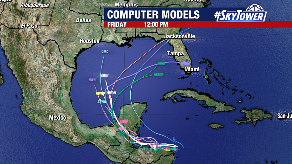
Models show Sara moving toward Florida during the mid-to-late portion of next week.
Once it reaches the Gulf, conditions are much less conducive for further intensification. From there, an area of high pressure will build to the north of the system and an eastward "sweep" over Florida is expected.
"By the time it gets here, given this forecast, there's not going to be much left to it," Osterberg said. "It just gets pulled apart by these upper level winds, and it's just a big wet mess."

Models show the system moving toward Florida next week, but likely not as a hurricane.
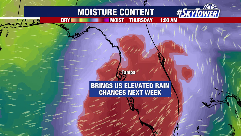
Any rain or wind from the system would move over Florida during the mid-to-late portion of next week, according to Osterberg.

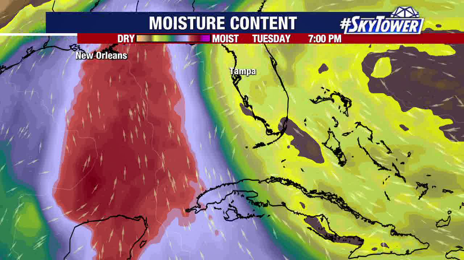
Sara, or its remnants, will bring higher rain chances to Florida next week.
It is worth noting that the forecast could see more changes over the next few days, so Sara will be worth watching through the weekend and into next week.
STAY CONNECTED WITH FOX 13 TAMPA BAY:
- Download the FOX Local app for your smart TV
- Download the FOX 13 News app for breaking news alerts, latest headlines
- Download the SkyTower Radar app
- Sign up for FOX 13’s daily newsletter

