

Dallas Weather: Severe storms move across metroplex ahead of triple-digit heat
Dallas weather: July 5 morning forecast
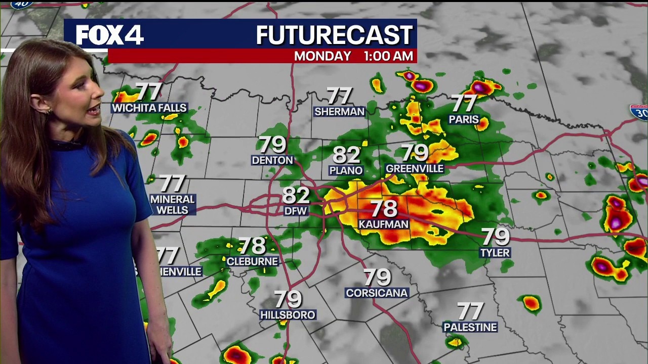
Increasing storm chances for Sunday and Monday. FOX 4 Meteorologist Kylie Capps has your forecast.
DALLAS - North Texas residents are in for a turbulent stretch of weather, with severe thunderstorms moving across the Metroplex Sunday before the forecast shifts to sweltering game day conditions Monday and the season's first triple-digit heat later this week.
Sunday: Storm Threat

Severe weather is unfolding across North Texas this afternoon as a weakening cold front collides with hot, humid air over the region.
A Severe Thunderstorm Watch remains in effect through 10 p.m. for much of North Texas, including the Dallas-Fort Worth metroplex.
Storms have already begun producing severe weather. Around 2:55 p.m., a storm west of Lake Ray Hubbard dropped dime-size hail south of downtown Garland. Meteorologists expect that storm to continue strengthening as it tracks east toward Sunnyvale and Mesquite.
Additional downpours and lightning are also developing across Dallas, signaling that storm coverage is increasing through the afternoon. The strongest storms through this evening will be capable of producing quarter-size hail, damaging wind gusts of 60 to 65 mph, frequent lightning, and torrential rainfall that could lead to localized flooding.
Residents are urged to stay weather aware and have multiple ways to receive warnings. Even storms that don't reach severe limits can produce dangerous cloud-to-ground lightning, so remember: If thunder roars, head indoors.
FIFA Fan Fest Delayed
The lightning threat has already prompted impacts across the Dallas-Fort Worth. FIFA Fan Festival Dallas temporarily halted entry Sunday afternoon because of lightning in the area, directing guests inside the venue to shelter in the main stage viewing area or leave the festival to seek safety in their personal vehicles until conditions improve.
Monday: Sweltering Game Day Forecast
The stormy setup is expected to clear out just enough for Monday afternoon’s 2 p.m. kickoff at Dallas Stadium. However, fans and outdoor spectators should prepare for intense heat and humidity.
Temperatures at kickoff will hover in the mid-90s under partly to mostly sunny skies. By the time the match wraps up, temperatures will peak in the upper 90s, with a stifling heat index making it feel like 100 to 101 degrees.
While the highest chance for remaining rain stays south of Interstate 20 and Arlington, a shifting boundary could still spark a 20% to 30% chance of afternoon showers and rumbles of thunder near the stadium. Those with outdoor plans for Monday are strongly advised to keep an eye on the radar.
Rest of the Week: Triple-Digit Heat Waves
Humidity will linger through Tuesday before a sprawling ridge of high pressure settles over Texas.
That ridge is expected to send temperatures soaring well above average, bringing North Texas its first stretch of triple-digit temperatures this season. Afternoon highs should climb to around 100 degrees beginning Wednesday, with dangerous heat likely continuing through the latter half of the week.

The Source: Information in this article is from the FOX 4 Weather team.