Tropical Storm Beryl Updates: Latest projected path, timing and impact on North Texas

Tropical Storm Beryl: Updated track, impact on Dallas
Tropical Storm Beryl is expected to make landfall on Monday morning in Texas. The impacts will be felt in parts of North Texas. FOX 4's Ali Turiano takes a look at the updated track and more.
Tropical Storm Beryl is expected to strengthen into a Category 1 hurricane on Sunday before making landfall in Texas early Monday morning.
The latest update on the storm's track and timing is a little different from what we were seeing on Saturday, and it will have an impact on what we see in North Texas.
When will Beryl make landfall?
The timeline for Beryl making landfall has moved up in the latest models.
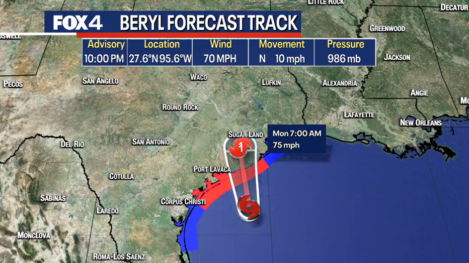
We are now looking at Beryl making landfall around 3 or 4 a.m. near Matagorda, about 100 miles southwest of Houston.
By Sunday night, wind speeds reached 70 miles per hour.
Infrared satellite shows the storm is becoming more organized as it slowly moves toward the coast.

Beryl will likely intensify to Category 1 hurricane late Sunday night before its Monday landfall.
READ MORE: How strong is a Category 1 hurricane?
Beryl's Projected Path

Right now, Beryl's projected path shows the storm making landfall in Matagorda, between Corpus Christi and Houston.
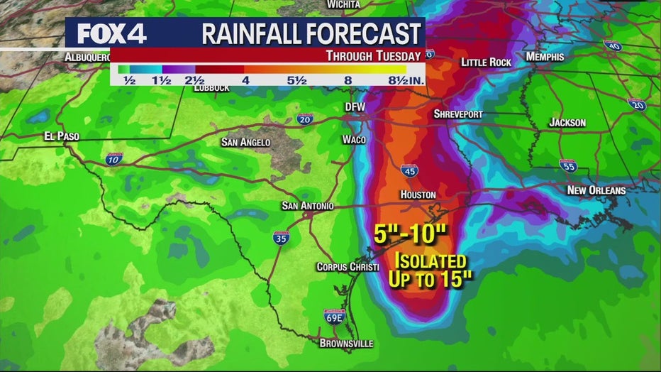
Significant storm surge is expected along the coast with some areas to see between 3 and 6 feet.
Hurricane warnings and storm surge watches and warnings are in place.
Once it makes landfall, it will lift to the north and then eventually to the northeast.

The National Hurricane Center has narrowed its cone of uncertainty, meaning it has honed in on the areas it expects to be affected.
Will Beryl Hit Dallas?
Because Beryl looks to have taken more of a northeast turn and the projected path has moved east, much of the Metroplex will not be as affected by the storm.

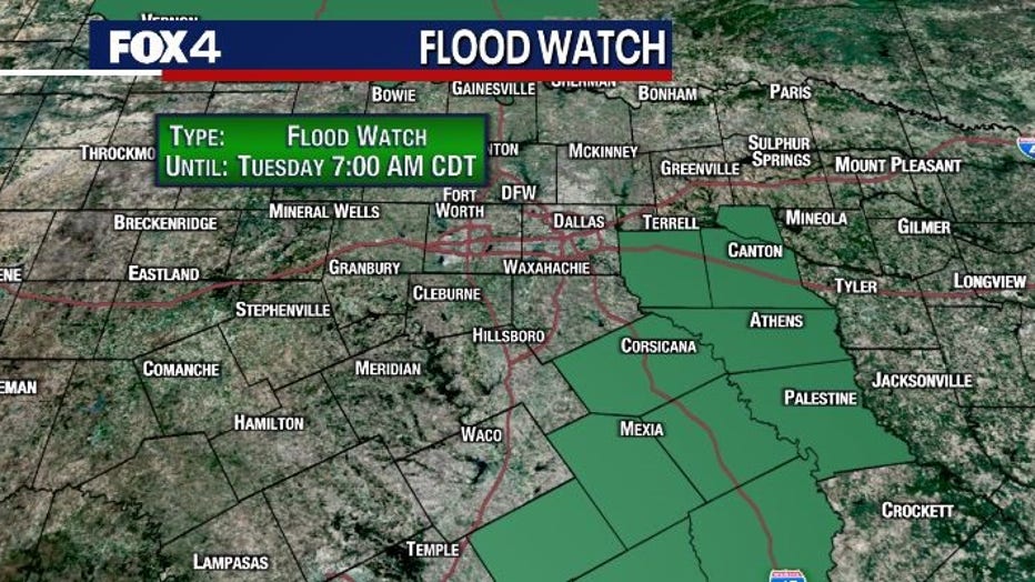
We are now focusing on the areas to the east and southeast of Dallas.
There is a low tornado threat well to our east as storms move through.
A flood watch is in effect starting Monday morning until Tuesday morning for those areas.

Still keep an eye on the forecast, because it will be feast or famine, depending on where you live.
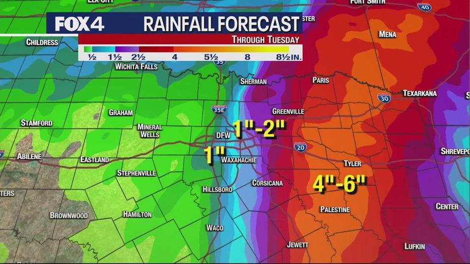
The east and southeast of the Metroplex could see 4 to 6 inches of rain. Areas west of I-35 will see minimal impact.
Places like Plano could see about 1 to 2 inches.
Because the storm is moving faster than expected, the storm will move out faster.
We will see wind gusts higher than 20 miles per hour.
Keep watching FOX 4 for updates as we get more information.

