

Dallas weather: North Texas prepares for severe flash flood threat as tropical moisture arrives
Dallas weather: Sept. 29 morning forecast
A Flood Watch is in effect for North Texas as remnants of Polo bring 2-4 inches of rain, severe storm potential, and a welcome drop in temperatures into the 60s and 80s.
DALLAS - North Texas is enjoying one final quiet, mostly sunny day Tuesday before a major shift brings rising humidity, windy conditions, and the threat of widespread heavy rain and flooding through the end of the workweek.
The region will see a high of around 88 degrees Tuesday afternoon under increasing high clouds streaming in from the west. South-southeast breezes will pick up, with gusts reaching up to 25 mph.
Flood Watch Issued
Conditions are expected to change dramatically by Wednesday afternoon. Tropical moisture surging from Hurricane Polo, combined with an approaching upper-level disturbance from the west, will trigger scattered showers and thunderstorms across the area.
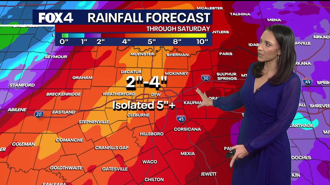
A flood watch is already in place for much of the region. Widespread rainfall totals of 2 to 4 inches are expected area-wide, with isolated higher amounts exceeding 5 inches possible, particularly from the I-35 corridor westward.
Live Radar
The heavy rain threat is projected to ramp up significantly Wednesday night into Thursday, creating a potentially wet and hazardous morning commute. The unsettled weather pattern is expected to linger through Friday as additional energy moves across the region, keeping rain chances elevated before gradually tapering off over the weekend.
Temperatures will drop significantly with the arrival of the rain and clouds, pushing the 90-degree heat out of the forecast by midweek.
Residents in flood-prone areas are advised to monitor the forecast closely and prepare for potential weather disruptions over the coming days.
7-Day Forecast

The Source: Information in that article is from the FOX 4 weather team.