

Dallas Weather: More extreme heat and elevated fire danger on Tuesday
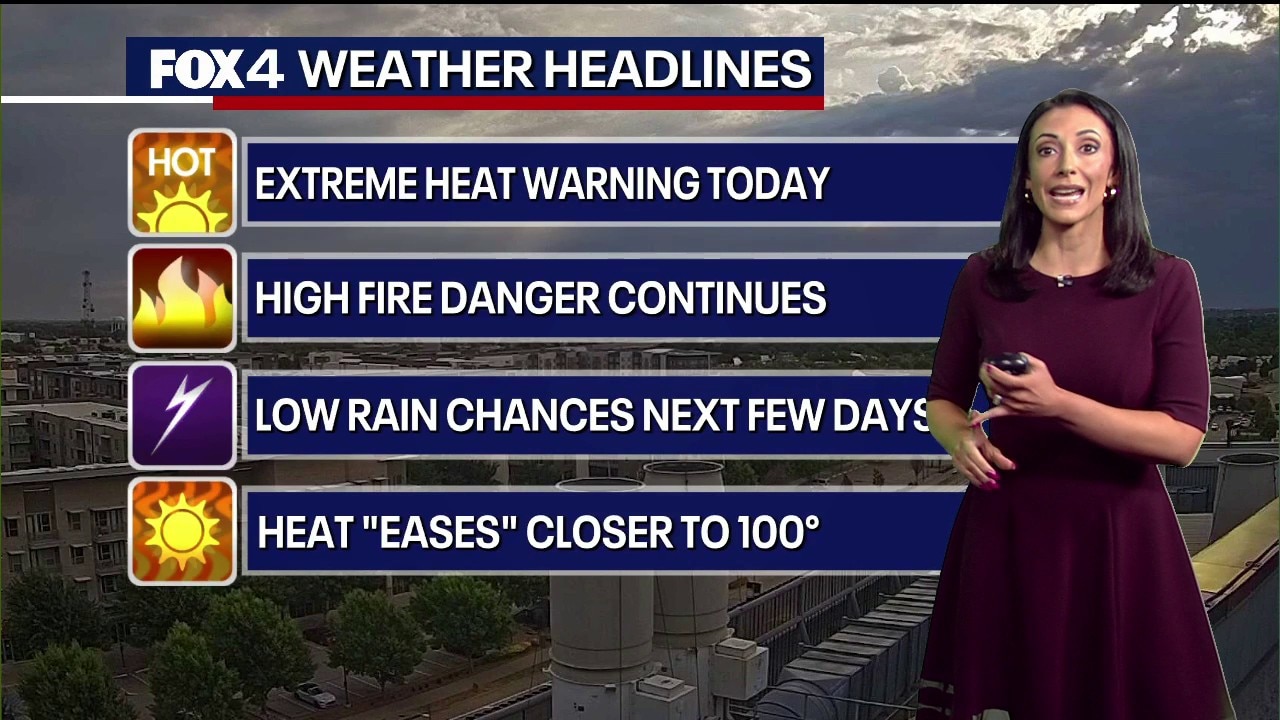
Dallas Weather: Aug. 25 morning forecast
FOX 4 Weather Meteorologist Ali Turiano gives an update on the weather forecast for Tuesday and the rest of the week.
DALLAS - North Texans should continue to be alert on Tuesday because of the excessive heat and elevated fire danger in the forecast.
Tuesday Forecast
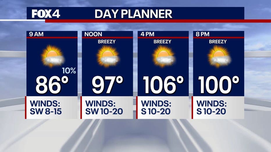
The National Weather Service has issued yet another Extreme Heat Warning for most of North Texas through 8 p.m. on Tuesday.
Temperatures are expected to be in the triple digits again with highs up to 106 degrees.
While there are some rain chances on Tuesday, they are mainly east of the Dallas-Fort Worth metroplex and will likely only be scattered showers. They won’t be much help for the wildfires burning west of Fort Worth.
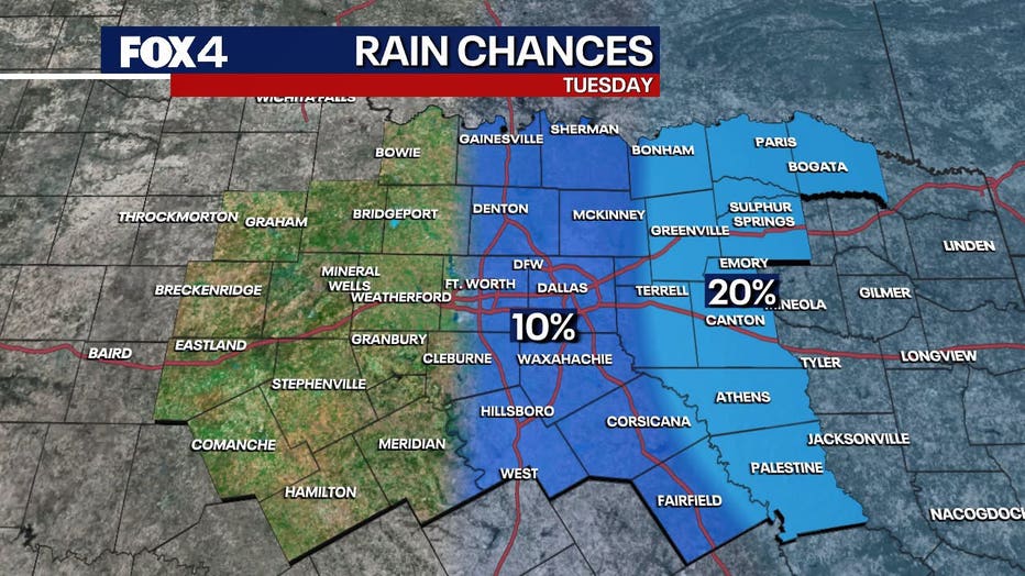
The fire threat remains very high area-wide on Tuesday with gusty winds, low humidity, and dry vegetation.
7-Day Forecast
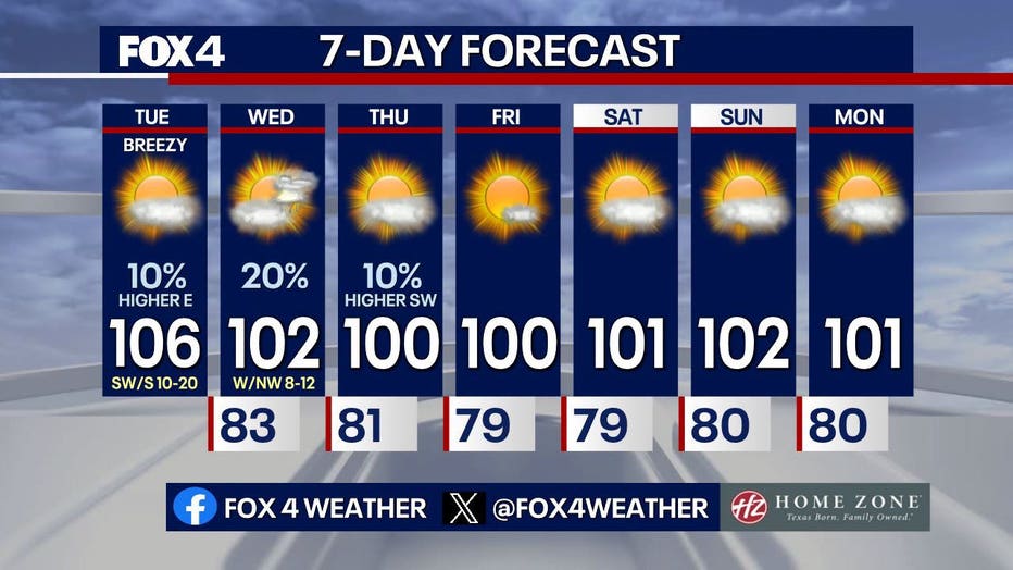
A weak front to our north slides into North Texas on Wednesday and will ease us closer to the century mark to end the week.
Low rain chances are expected to continue into Thursday.
Sunshine and triple-digit heat continue this weekend
Prevent Wildfires
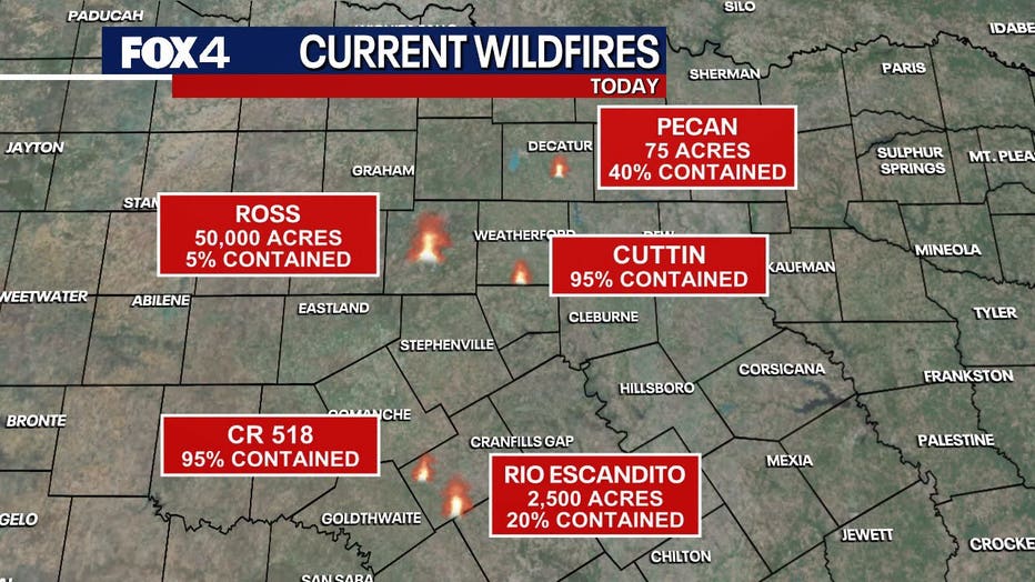
Most counties in North Texas are currently under a burn ban. Even if you don't live in an area where there is an active burn ban, experts say you should act as if you are because of how dry things are right now.
You can also do your part to help prevent wildfires by not:
- Tossing lit cigarettes on the ground
- Dragging loose tow chains
- Parking or driving over tall grass
- Leaving campfires unattended
- Burning unnecessarily
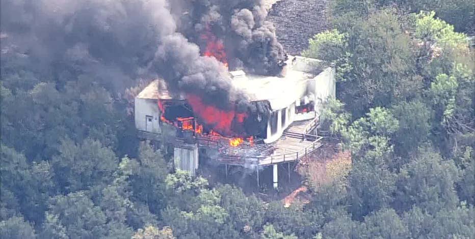
Ross Fire grows to 50,000 acres west of Fort Worth, evacuations ordered
The 50,000-acre Ross Fire has prompted mandatory and recommended evacuations in Palo Pinto and Jack counties as dry, windy conditions fuel multiple wildfires across North Texas.
The Source: The information in this story comes from the FOX 4 Weather team and the National Weather Service.