

Dallas weather: Severe Thunderstorm Warning, golf ball-sized hail hits North Texas overnight

Dallas Weather: March 26 noon forecast
FOX 4 Weather Meteorologist Dylan Federico gives an update on rain chances for Wednesday and later in the week.
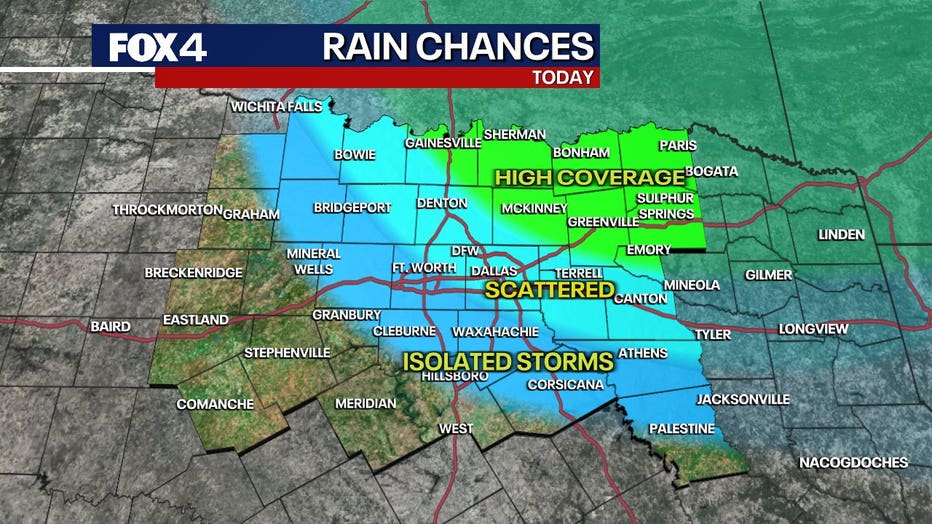
DALLAS - North Texas will see more rain this week, with scattered showers moving through the area. While conditions will remain calm for the next few days, some areas will experience consistent rainfall.
Wednesday's Forecast: Cool start, warm finish
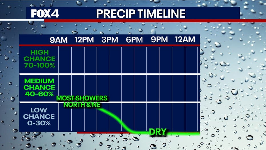
A disturbance will bring rain to areas north and east of the Metroplex today. Some showers are possible in Dallas-Fort Worth, but the heaviest rain will stay to the north and northeast. Lingering clouds will keep temperatures in the 60s in those areas.
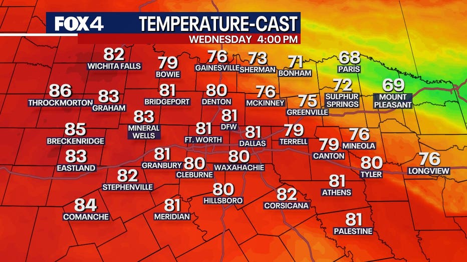
DFW will see drier conditions, allowing temperatures to climb to 80 degrees or higher under partly sunny skies.
Severe storms bring hail to North Texas

Collin County hit hard by golf ball-sized hail
Homes and cars were pelted by hail in Dallas and surrounding areas Tuesday night. FOX 4 reporter Dan Godwin is in Collin County with the aftermath of the storm.
Severe storms swept through parts of North Texas on Tuesday night, bringing heavy rounds of hail.
The cities of Allen and Parker in Collin County reported golf ball-sized hail.
Thursday's Forecast: Increased rain coverage
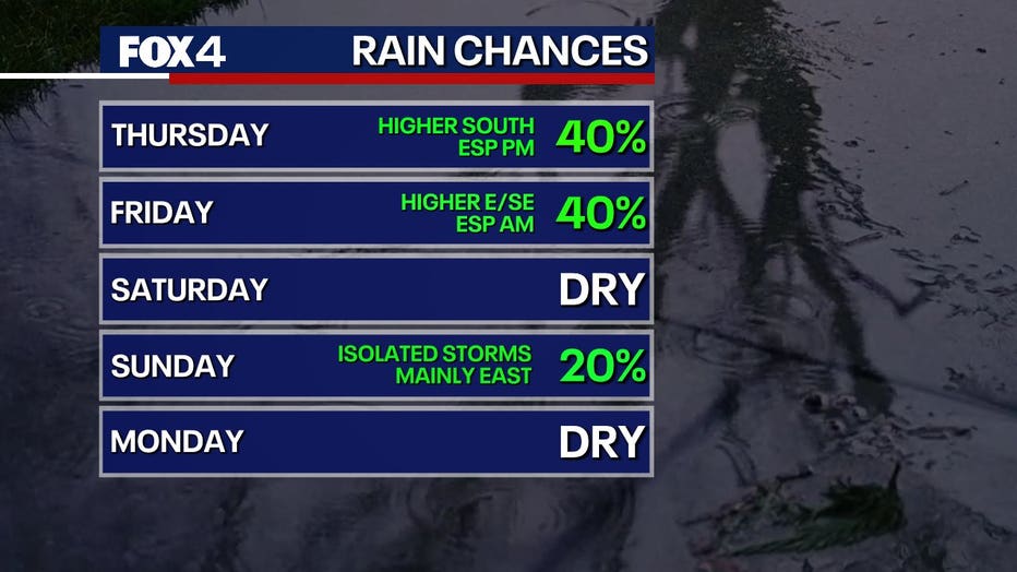
On Thursday, southern parts of the Metroplex will see the most rain. Clouds will move in during the morning, keeping temperatures cooler, with highs only reaching the 70s. Showers will move in from the south throughout the day but are not expected to be heavy. Rain will continue on and off into Thursday night.
Friday's Forecast: Scattered showers east of DFW
The highest rain coverage on Friday will be east and southeast of Dallas. Not everyone in the Metroplex will see rain, but clouds will dominate the area. Highs will remain in the 70s.
Weekend outlook: Warm and humid
The weekend will be warm and humid. Saturday morning will start cloudy before gusty winds move in, bringing highs in the 80s. A dry line could push temperatures near 90 degrees west of Fort Worth. Storms are not expected.
On Sunday, another dry line will develop, followed by a cold front in the afternoon. Storms are possible.
Severe Thunderstorm Warning
Severe storms could develop Sunday in eastern parts of North Texas.
7-Day Forecast

Cooler, more stable air arrives Monday. Brisk north winds will keep temperatures in the 70s, but a gradual warm-up is expected by Tuesday. No showers are expected early next week.
The Source: Information in this article comes from the National Weather Service and meteorologist Evan Andrews.