

Dallas weather: Windy and dusty end to winter; sunny start to spring ahead
Dallas weather: Mar. 19 morning forecast
Another windy day in DFW as the last day of winter rolls through. But, will we see a sunny start to spring? Meteorologist Evan Andrews has your forecast.
DALLAS - North Texas will see a windy and dusty end to winter before a sunny start to spring on Thursday.
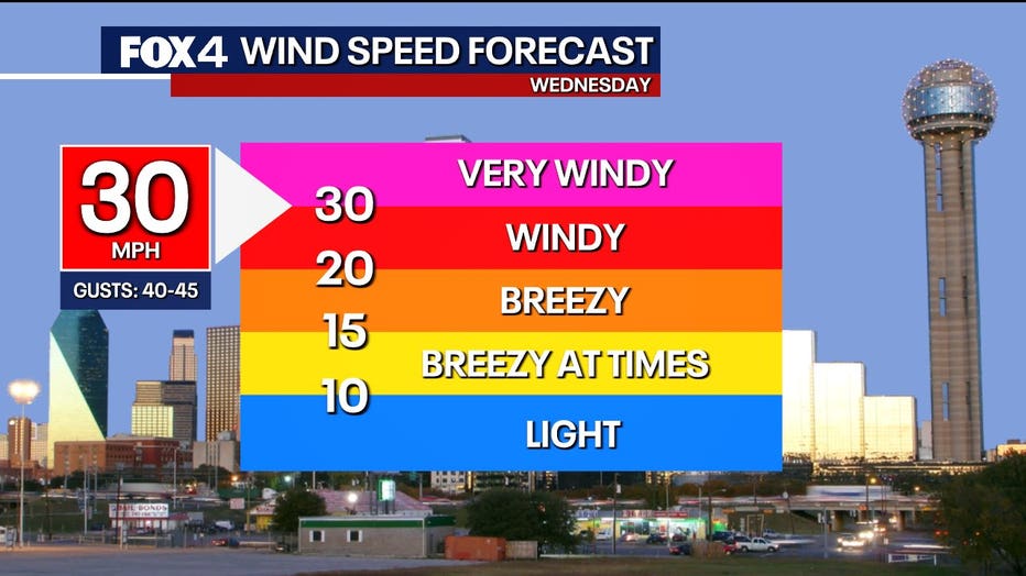
Wednesday’s Forecast: Cool and windy
What we know:
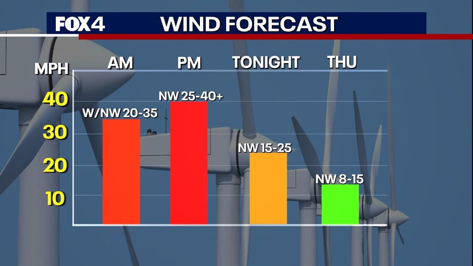
Winds will be similar to Tuesday but much cooler. Brief west winds Wednesday morning will bring in dust from West Texas, but conditions should improve later in the night.
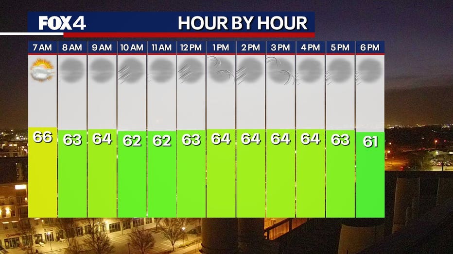
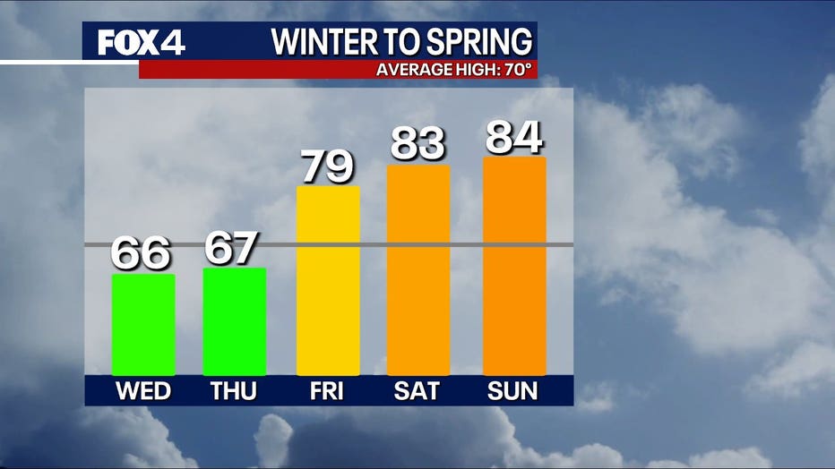
Despite sunny skies, temperatures will struggle to rise above the mid-60s. Afternoon highs will likely hover around 60 degrees. With gusty winds between 25 and 40 mph, it will feel even cooler.
Winds will diminish Wednesday night, and temperatures will drop quickly.
Thursday’s Forecast: Chilly start to spring, light freeze possible
What's next:
Thursday marks the first day of spring, but it will start off cold. Early morning temperatures will be near 40 degrees, with some areas north and west of the Metroplex potentially seeing a light freeze with lows in the 30s.
Sunny skies and light winds will help temperatures climb into the mid- to upper 60s by the afternoon. The seasonal average for this day is 70 degrees.
Friday’s Forecast: A beautiful, sunny day
Friday is meteorologist Evan Andrews’ "pick day" of the week.
A briefly cool morning will give way to sunny skies, with afternoon highs approaching the 80s. South winds will increase throughout the day.
Weekend Forecast: Warm, humid, and breezy
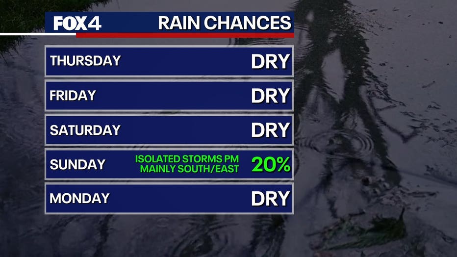
Saturday will be warm, with highs in the 80s.
Sunday will be warm and humid ahead of a cold front moving through the Metroplex in the afternoon. This front could produce storms, with the potential for gusty winds and some hail. Storm coverage in the Dallas-Fort Worth area is expected to be around 20%, while areas in southeastern North Texas could see higher chances near 30%.
7-Day Forecast

The Source: Information in this article comes from the National Weather Service and meteorologist Evan Andrews.