

Dallas weather: Record-low temperature already broken; rain and warm weather ahead
Dallas weather: Feb. 20 morning forecast
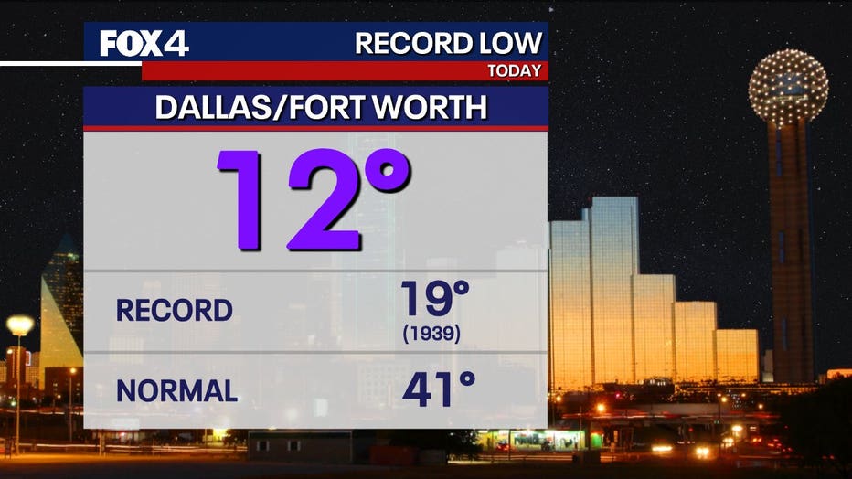
We already broke the record-low temperature today when temps reached a freezing 13 degrees this morning. Meteorologist Evan Andrews has your forecast.
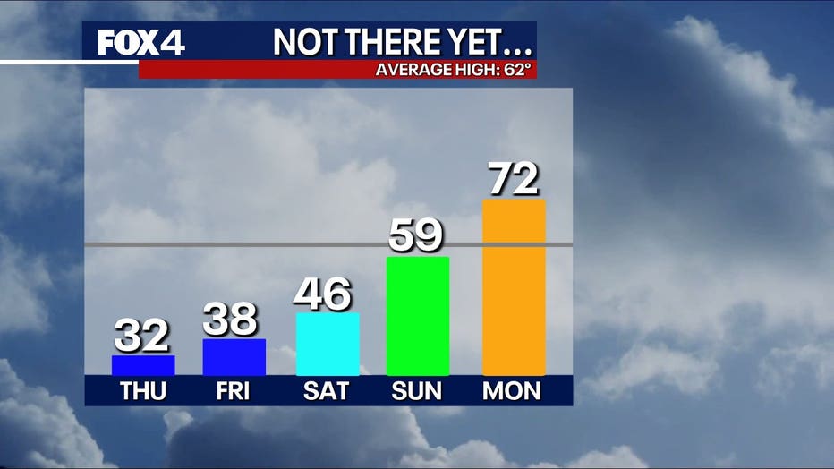
DALLAS - We have just two more days of freezing cold before Texans can finally start to thaw out.
A Cold Weather Warning remains in effect for North Texas until Thursday evening.
Thursday Forecast: Record-low temperatures, wind chills near zero
Today starts off much like Wednesday, with clearer skies and drier air but less wind. Wind chills remain near zero degrees, and small flurries are possible in southern parts of the DFW lakes due to lake effect snow with north winds.
The record-low temperature for Feb. 20 was 18 degrees, set in 1939. That record was already broken by 5 a.m.
Winds will diminish later in the day, and temperatures will drop into the high teens again tonight.
Friday Forecast: Cloudy and cold
Cloud cover will increase Friday, especially in the southern parts of the Metroplex.
Temperatures should reach the mid-to-upper 30s, but if clouds linger all day, highs may be lower.
Weekend Forecast: Cloudy and still chilly
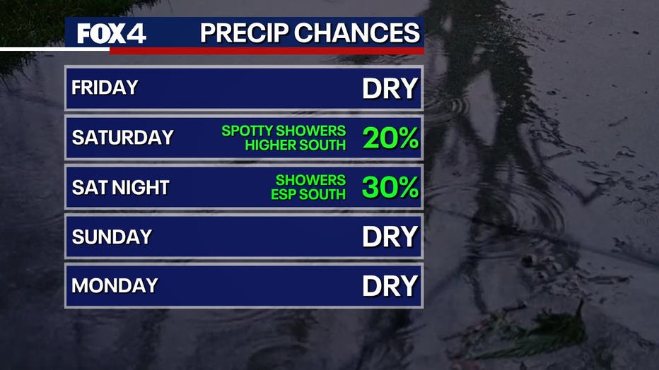
Saturday and Sunday will be mostly cloudy, keeping temperatures from rising much above 40 degrees on Saturday. Rain chances remain low during the day but increase Saturday night.
By Sunday, we’re hopeful this cold system will move out, allowing temperatures to climb into the upper 50s and possibly low 60s.
Next week’s forecast: A well-earned warm-up!

The warm-up finally arrives next week—because let’s be honest, we deserve it after this brutal stretch!
Monday will be mostly sunny with highs in the low 70s. Tuesday and Wednesday will also see temperatures in the low to mid-70s.
The Source: Information in this article comes from the National Weather Service and meteorologist Evan Andrews.