

Dallas Weather: Strong storms bring damaging winds, hail to parts of North Texas
DALLAS - North Texas saw a slight break from the extreme heat on Wednesday before strong storms moved into the area.
Severe Thunderstorm Warning
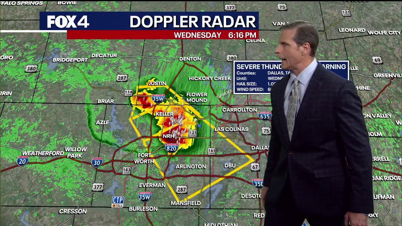
Dallas weather: August 26 evening forecast
FOX 4 chief meteorologist Dan Henry has more on the intense heat in North Texas and the surprise thunderstorms popping up in Tarrant County in this evening forecast for August 26.
Strong storms popped up in North Texas on Wednesday evening.
A Severe Thunderstorm Warning went into effect for Denton, Tarrant, and Wise County until 6:30pm and Dallas and Tarrant County until 7:00pm.
There are reports of damage to trees and pea-sized hail in Rhome and on the Fort Worth-Watauga border. Outdoor warning sirens were activated in Haslet for hail. At 6:30 pm, Oncor reported 6,472 power outages in Tarrant County.
FOX 4 viewers shared photos and videos of wind and hail.
Wednesday Forecast
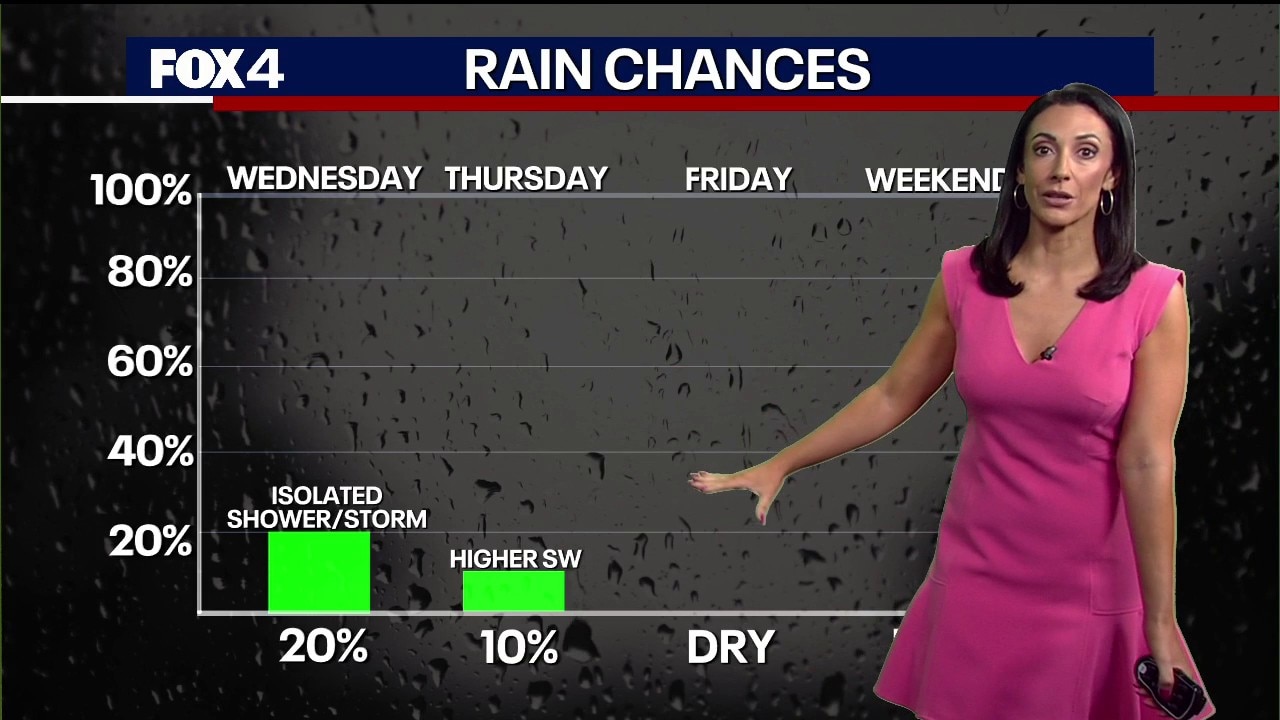
Dallas Weather: Aug. 26 morning forecast
FOX 4 Weather Meteorologist Ali Turiano has an update on the triple-digit heat, fire danger, and rain chances in the forecast.
A weak front slowly moves through North Texas on Wednesday, bringing isolated showers and storms.
It will still be hot, but with highs between 99 and 103 degrees depending on where you live.
There is only a Heat Advisory and no Extreme Heat Warning in effect for North Texas on Wednesday.
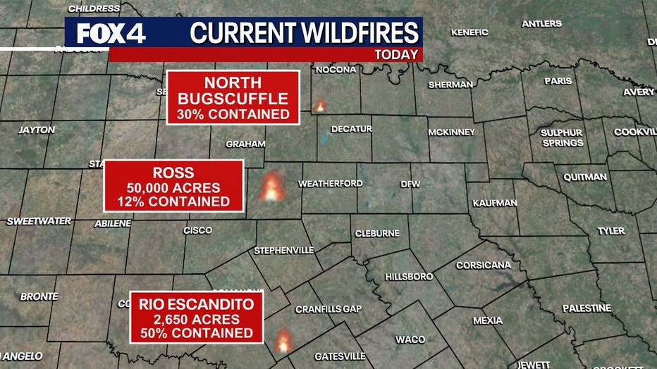
The fire danger will also be slightly lower on Wednesday due to the lighter winds.
However, it’s still dry out there and folks should still take precautions to prevent fires.
Smoke from the ongoing wildfires out in Palo Pinto and Jack counties could be visible in other parts of North Texas.
7-Day Forecast
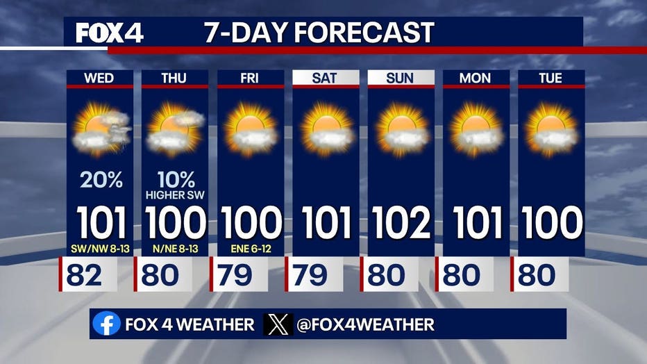
By Thursday, the front heads south and will take the rain chances with it. After Thursday, another dry stretch is expected.
But the extreme heat will ease a bit. Morning lows will range from the mid-70s to low 80s and afternoon highs will be in the mid-90s to low 100s.
The ridge of high pressure heads back east over the weekend.
The Source: The information for this story comes from the FOX 4 Weather team and the National Weather Service.