Dallas weather: Storms in the forecast Monday into Tuesday

Dallas weather: April 15 afternoon forecast
Parts of North Texas could see rain and storms on Monday night. FOX 4's Dylan Federico takes a look.
There is a large area of the country at risk for severe storms on Monday night.
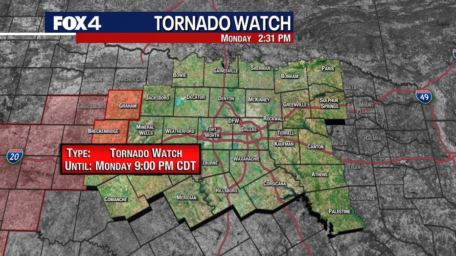
The worst weather is expected to miss North Texas, with the highest risks in Oklahoma and northwest Texas.
The highest chance of storms will be to the west of Dallas-Fort Worth.
A tornado watch was issued until 9 p.m. for our far western counties.

For those of us that live in DFW the chances of seeing severe weather is low. The Storm Prediction Center ranks much of the area at a 1 on its 1 to 5 scale.
Most of the day should be nice on Monday.
There will be a strong cap in place, but we can't rule out the chance of a stray shower or two.

Severe Weather Explained: What is the 'Cap'?
FOX 4 Meteorologist Dan Henry explains what the "cap" is, as it's a term used a lot during severe weather.
The overnight hours are when we expect the weather to be the roughest.
Still, less than half of people in the Metroplex are expected to see rain.
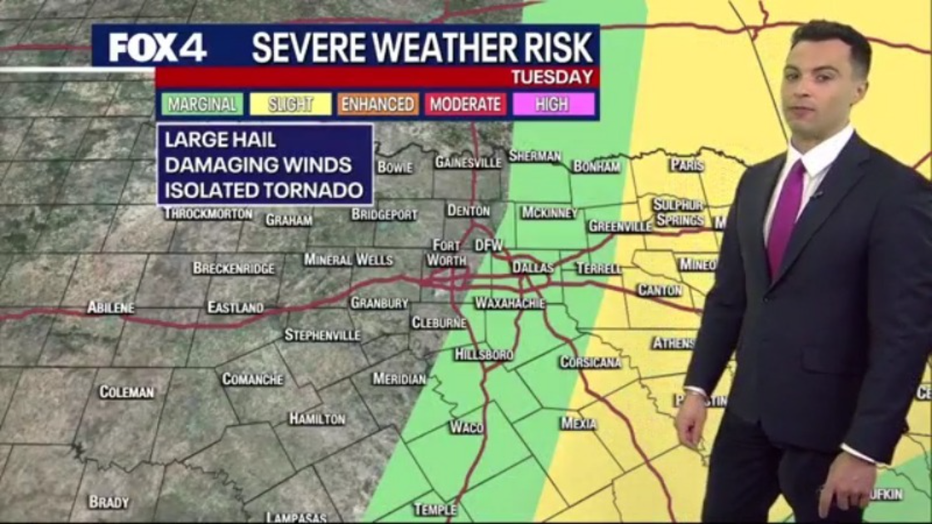
Tuesday Forecast: Storm chances move east

As the disturbance moves through the area Monday night into Tuesday, the severe weather risk moves to the east.
The day may start out rainy for Dallas-Fort Worth, but conditions are expected to improve into Tuesday afternoon.
7-Day Forecast

Things will dry out Wednesday, but the rest of the week is pretty uncertain at this point.
Thursday, Friday and even Saturday could see another shot at showers and storms.

