Tropical Storm Francine in Gulf: Hurricane threat looms for Texas, Louisiana; tropical storm watch issued
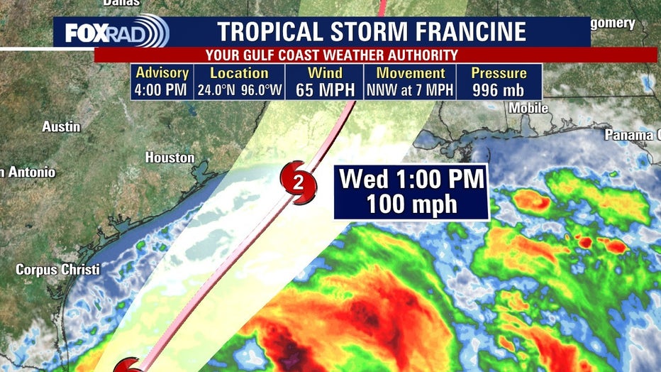
HOUSTON - Tropical Storm Francine has officially formed in the western Gulf of Mexico, and it’s expected to become a hurricane as it heads toward the Texas-Louisiana coast by midweek.

Latest forecasts show that Tropical Storm Francince is forecaster to become a category 2 hurricane before landfall on the Lousiana coast.

As of the 10 p.m. Monday update, Tropical Storm Francine has maximum sustained winds of 65 miles per hour and is moving north-northwest at five miles per hour. The storm is located about 125 miles south-southeast of the mouth of the Rio Grande or about 420 miles south-southwest of Cameron, Louisiana.
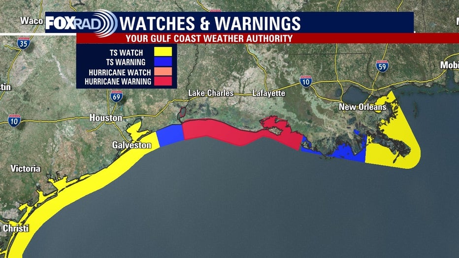
The National Hurricane Center has issued the following watches and warnings:
A Storm Surge Warning is in effect for...
* High Island Texas to the Mouth of the Mississippi River Louisiana
* Vermilion Bay
A Hurricane Warning is in effect for...
* The Louisiana coast from Sabine Pass eastward to Morgan City
A Storm Surge Watch is in effect for...
* Mouth of the Mississippi River Louisiana to the
Mississippi/Alabama Border
* Lake Maurepas
* Lake Pontchartrain
A Hurricane Watch is in effect for...
* The Louisiana coast from Morgan City eastward to Grand Isle
A Tropical Storm Warning is in effect for...
* Morgan City to Grand Isle
* High Island to Sabine Pass
A Tropical Storm Watch is in effect for...
* Barra del Tordo to the Mouth of the Rio Grande
* Mouth of the Rio Grande to High Island Texas
* East of Grand Isle Louisiana to Mouth of the Pearl River,
including metropolitan New Orleans
* Lake Pontchartrain
* Lake Maurepas

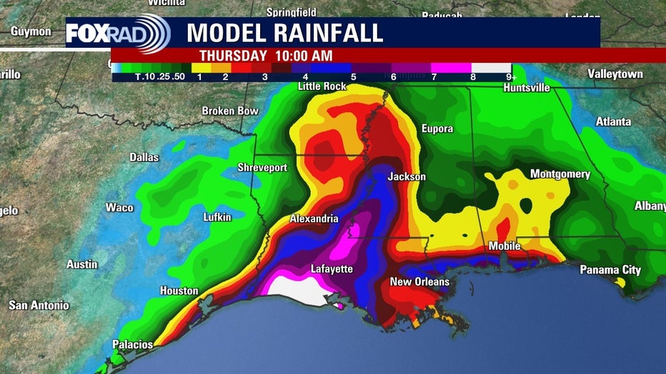
The National Weather Service says damaging and life-threatening hurricane-force winds are expected in portions of southern Louisiana Wednesday, where a hurricane warning is now in effect. Preparations to protect life and property should be complete by Tuesday night since tropical storm conditions are expected to begin within the area early Wednesday.


