

Hurricane Oscar makes second landfall in Cuba on Sunday after slamming Bahamas as Category 1
Hurricane Oscar maintained Category 1 strength as the small hurricane made a second landfall in Cuba Sunday evening after rapidly intensifying over the weekend and making its first landfall in the Bahamas earlier in the day.
Oscar rapidly intensified from a tropical storm into an 85-mph hurricane on Saturday, causing islands in its potential path to issue watches and warnings ahead of the system’s arrival.
Hurricane Oscar already made one landfall early Sunday morning on Great Inagua Island in the Bahamas as a Category 1 hurricane with winds of 80 mph just before 5 a.m. ET.
Perhaps some good news is that Oscar is expected to weaken to a tropical storm as it moves across eastern Cuba Sunday night and Monday, but it's still expected to produce strong winds and torrential rain in the region before moving back across the central Bahamas on Tuesday.
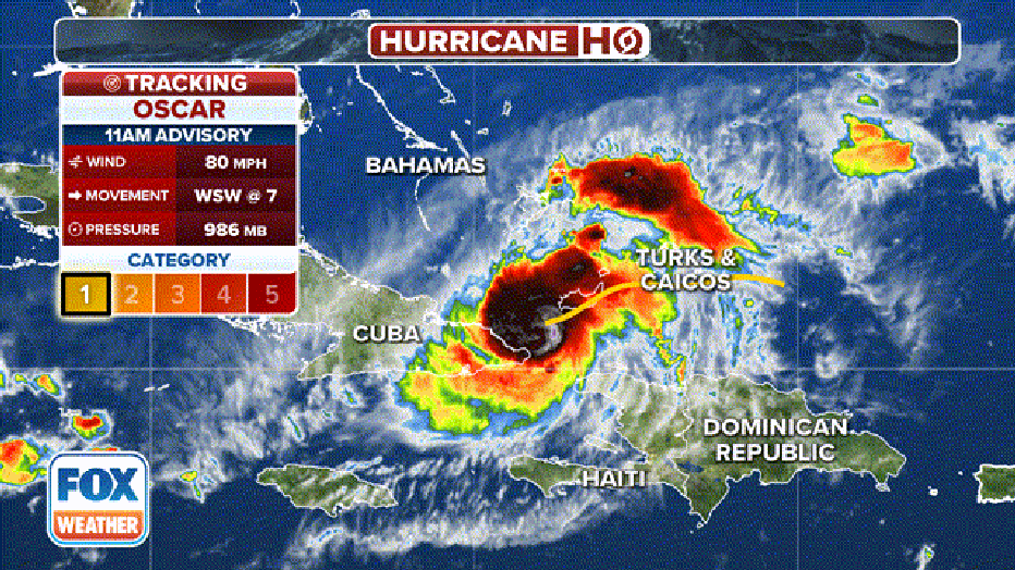
Tracking Hurricane Oscar. (FOX Weather)
The hurricane, previously designated Invest 94L, was barely hanging on to its prospects for tropical development Friday. But Oscar found a patch of warm water and atmospheric conditions to its liking, rapidly developing a well-defined center Saturday morning.
In addition to the gusty winds, rainfall amounts of 2-4 inches, with isolated totals to 6 inches, are expected across the region through Tuesday.
Hurricane Warnings remain in effect for the southeastern Bahamas and the north coast of the Cuban Provinces of Holguin and Guantanamo to Punta Maisi. Tropical Storm Warnings remain in effect across eastern Cuba, and the government of the Bahamas issued a new Tropical Storm Watch for the Central Bahamas late Sunday morning.
WHAT TO DO WHEN HURRICANE OR TROPICAL STORM WATCHES AND WARNINGS ARE ISSUED
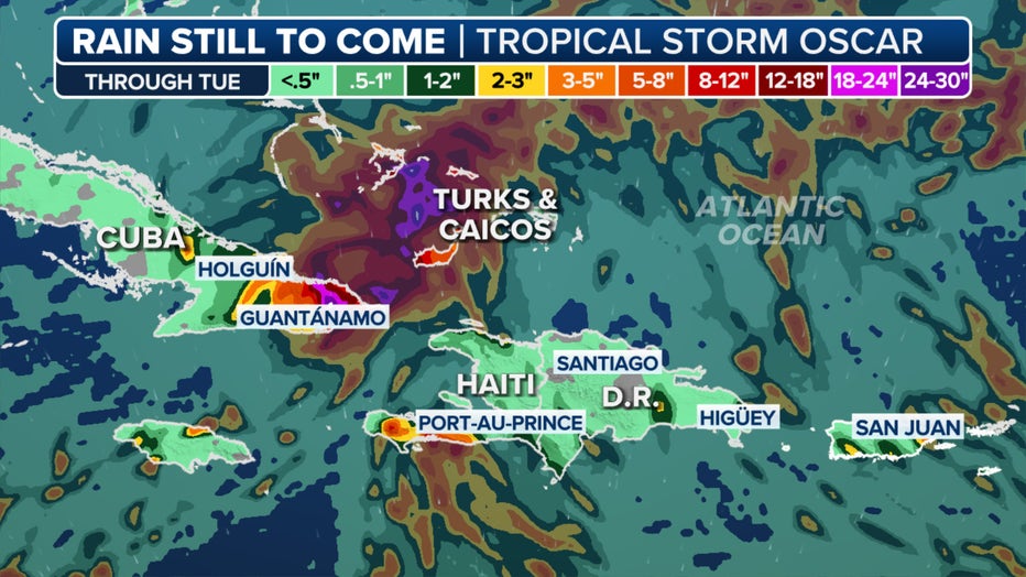
Hurricane Oscar rainfall forecast. (FOX Weather)
The hurricane is one of the smallest cyclones on record in the Atlantic Basin, with hurricane-force winds (74-plus mph) that only extended outwards 5 miles from the center. That area grew to 10 miles as of the latest advisory from the NHC.
A Hurricane Hunter aircraft also determined the cyclone's eye was just more than 3 miles wide, making it one of the smallest features since Hurricane Wilma in 2005.
Due to Oscar's small size, fluctuations in intensity will be common, as the cyclone can take advantage of pockets of dry air and shear.
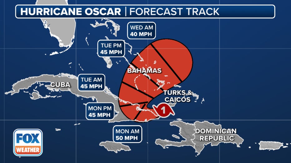
Hurricane Oscar forecast cone. (FOX Weather)
Oscar became the second named storm to get a name on Saturday, joining Tropical Storm Nadine, which was christened early Saturday morning near Belize.
The NHC says Oscar is expected to continue on a west-southwestward or westward track through Sunday night, followed by a turn to the northwest and north on Monday and Tuesday.
On that track, the NHC said Hurricane Oscar could make landfall along the northeastern coast of Cuba before moving across the region before accelerating northeastward across the central Bahamas on Tuesday.
TROPICAL STORM NADINE MAKES LANDFALL IN BELIZE THREATENING TORRENTIAL RAINS INTO SOUTHERN MEXICO
Could Oscar reach the US?
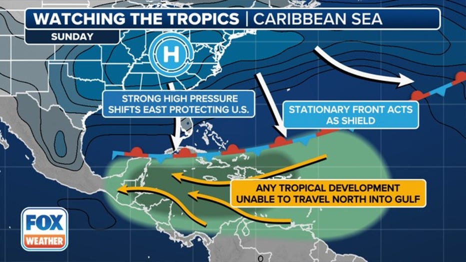
The weather pattern that will steer Oscar away from Florida and the Southeast U.S. (FOX Weather)
While the northeastern Caribbean islands monitor Oscar's progress, the storm remains no threat to the U.S.
An expansive ridge of high pressure anchored over the East Coast is acting like a protective barrier, with a front at the ridge’s boundary providing hostile atmospheric conditions for any tropical systems to approach Florida or the Southeast coast.
LINK: Get updates on Oscar and more at foxweather.com.