Ernesto weakens to tropical storm but could regain hurricane strength as it heads toward Atlantic Canada
Ernesto weakened to a tropical storm as it slowly pulled away from Bermuda Sunday morning, but forecasters say the storm could regain hurricane strength as it tracks into the northern Atlantic, where parts of Newfoundland, Canada, could be threatened by Ernesto early this week.
Ernesto made landfall on the western side of Bermuda as a Category 1 hurricane early Saturday, slamming the island with 85-mph winds, heavy rain, large surf and dangerous storm surge.
But the storm has had a deadly impact on the U.S. hundreds of miles away.
At least two deaths in South Carolina have been attributed to the powerful rip currents that developed because of Ernesto, and those dangerous beach conditions are expected to last for days from Florida to the Northeast.
WATCH: HURRICANE ERNESTO'S SWELL CAUSES NORTH CAROLINA HOUSE TO COLLAPSE INTO OCEAN
Video taken during the hurricane's arrival in Bermuda showed waves battering the coastline. More than 5,000 customers were without power on Friday evening. By Saturday morning, that number had grown to more than 26,000 customers, according to BELCO, the power company that services Bermuda. The utility company said that equates to about 72% of its customers.
As of Sunday, those outage numbers dropped to more than 14,000.
SEE THE IMPACTS HURRICANE ERNESTO WILL HAVE ON US COAST
What's the forecast for Hurricane Ernesto?

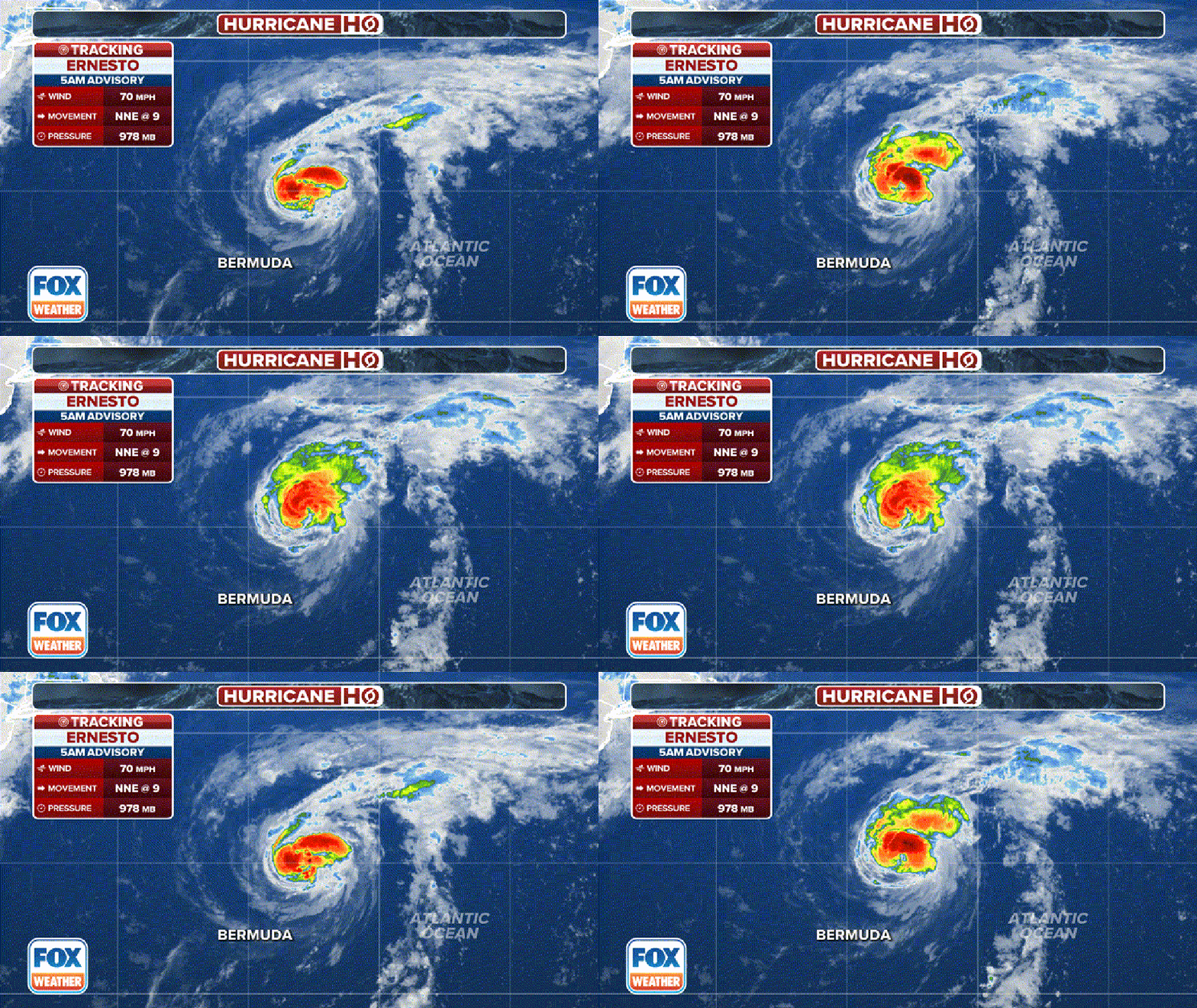
Tracking Ernesto(FOX WEATHER)
According to the latest advisory from the NHC, Ernesto weakened to a tropical storm and had winds of 70 mph with some higher gusts. The NHC said some re-intensification is possible later Sunday, and Ernesto could regain hurricane strength.
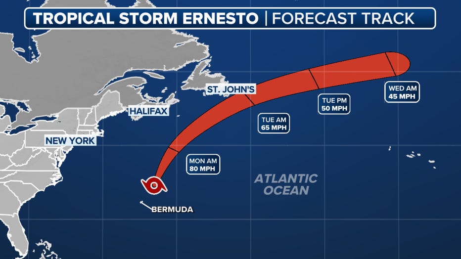
After that, the NHC said Ernesto will likely become post-tropical near southeastern Newfoundland, Canada, by Monday night or Tuesday morning.
Tropical Storm Ernesto is currently located just under 1,000 miles southwest of Cape Race, Newfoundland, and was moving to the north-northeast at 9 mph.
2024 ATLANTIC HURRICANE SEASON GUIDE: HERE'S WHAT TO KNOW ABOUT THIS YEAR'S STORMS

The forecast cone for Hurricane Ernesto.(FOX Weather)
The NHC said Ernesto should pick up some forward speed later Sunday, followed by a turn to the northeast and then east-northeast on Monday and Tuesday. On that track, the center of Ernesto will pass near southeastern Newfoundland late Monday and Monday night.
As a result, a Tropical Storm or Hurricane Watch might be issued for portions of southeastern Newfoundland later Sunday.
Ernesto impacting US mainland despite being hundreds of miles away
Ernesto hasn't directly impacted the mainland U.S. However, large swells generated by Ernesto reached the East Coast this weekend. The large waves are causing life-threatening surf and rip currents at beaches.
On Saturday, officials on Nantucket island in Massachusetts said that all South Shore beaches had been closed to swimmers. Similarly, officials in the town of Duck on the North Carolina coast are flying double-red flags because of dangerous waves and rip currents.
WHAT DO THE FLAGS AT THE BEACH MEAN?
Swells produced by Ernesto led to at least one house collapsing along North Carolina’s Outer Banks on Friday, with the threat of problems caused by high ocean levels expected to continue into the week ahead.
Farther south, around Hilton Head, South Carolina, local authorities reported the deaths of two swimmers. Both are believed to be victims of rip currents.
The Beaufort County Sheriff's Office said a 65-year-old man and a 73-year-old man received CPR after being brought back to shore by lifeguards during separate incidents on Friday.
The National Weather Service had warned of a high rip current risk and a surf height of at least 2-3 feet near the Georgia-South Carolina border before the tragedies.
Ernesto blasts Puerto Rico, US Virgin Islands with flooding rain, damaging winds
The U.S. territories of Puerto Rico and the U.S. Virgin Islands were blasted by the effects of then-Tropical Storm Ernesto as the storm moved across the region last Tuesday night and into Wednesday.
Numerous Flash Flood Warnings were issued across Puerto Rico, including in San Juan, where FOX Weather Correspondent Nicole Valdes was hunkering down and gathering information on how the storm impacted the island.
Valdes reported that more than 700,000 people on the island were without power after the tropical storm passed and strengthened into a hurricane.
Nearly 10 inches of rain fell in Naguabo, while the community of Barran picked up over 8 inches. More than a half-foot of rain also fell in Juncos, Villaba and Vieques.
Flooding was a major concern in Puerto Rico, and there were reports of people being trapped in vehicles and homes as rushing floodwaters cut off escape routes.
Power outages also skyrocketed across the region, with Luma Energy reporting more than 560,000 outages island-wide at the height of the storm.
But it wasn't only Puerto Rico that felt the storm’s effects.
The U.S. Virgin Islands were also blasted with strong winds and heavy rain, and a majority of the islands of St. Thomas, St. John and St. Croix were without power.

