

Dallas weather: Severe storms bring threat of large hail and 75 mph winds
Dallas weather: May 10 overnight forecast
FOX 4's Josh Johns gives the latest weather forecast and where it came from as severe weather warnings tread around North Texas.
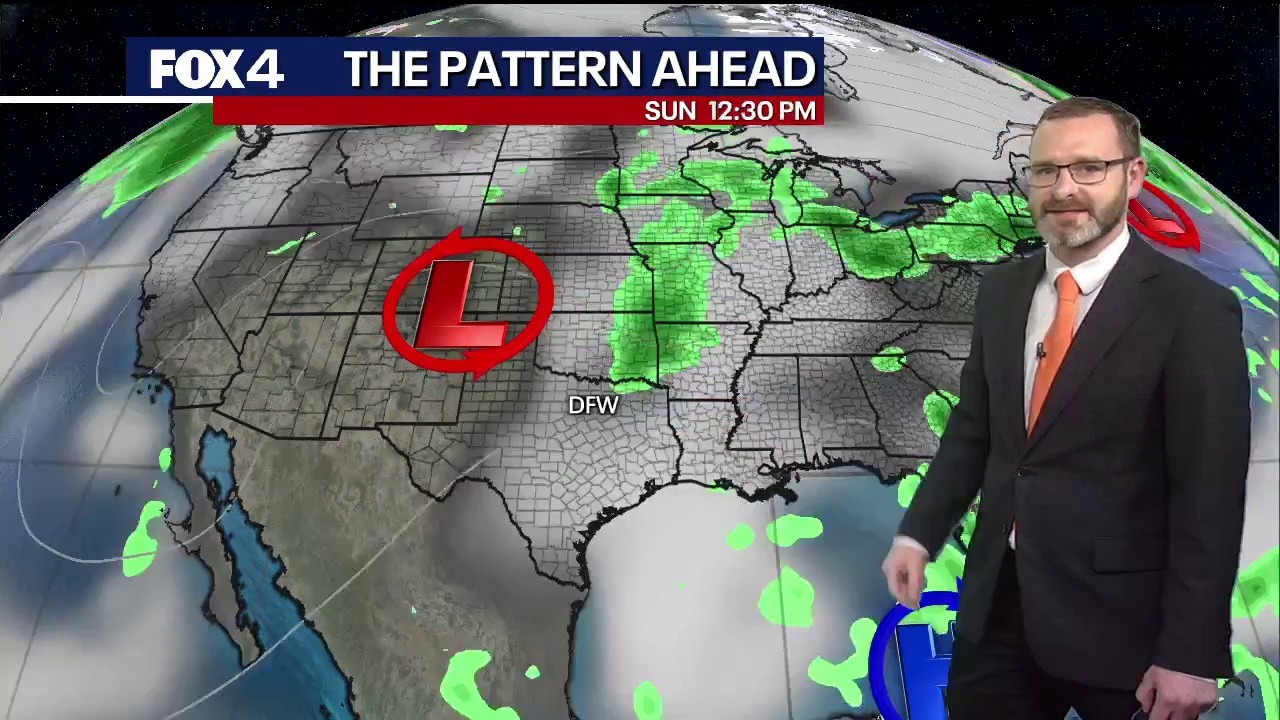
DALLAS - A powerful cold front sweeping across North and Central Texas on Sunday is expected to trigger a wave of severe thunderstorms capable of producing large hail, dangerous winds, and isolated flash flooding.
4:14 p.m. update
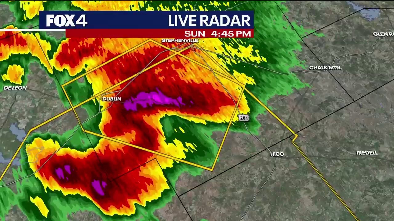
Dallas weather: Golf ball sized hail for North Texas
FOX 4's Josh Johns gives the latest severe weather update for towns such as Dublin, who are witnessing golf ball sized hail.
A new severe thunderstorm warning was issued for Erath County through 5:15 p.m. showing potential for hen eggs or golf ball size hail and 60 mph winds moving east to southeast.
3:27 p.m. update
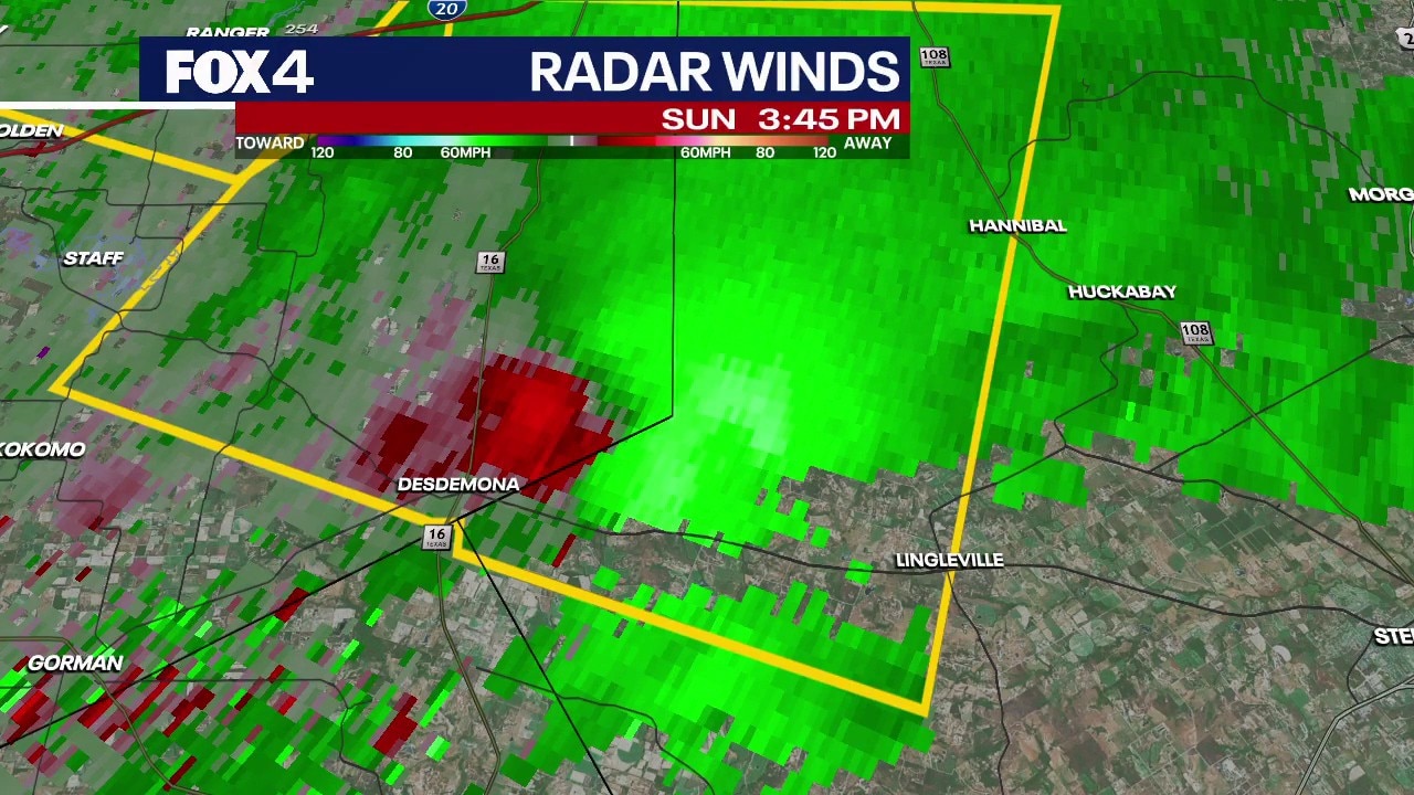
Severe thunderstorm warnings issued for North Texas
FOX 4's Josh Johns breaks down the severe weather path and hail sizes for the upcoming severe weather expected in North Texas
Severe thunderstorm warnings were issued for Eastland County and Erath County through 4:30 p.m. The ping pong ball-sized hail could be paired with winds of up to 60 mph.
1:40 p.m. update

The National Weather Service has issued a severe thunderstorm watch until 9 p.m. for the following counties:
Bell, Borden, Bosque, Brown, Coleman, Comanche, Concho, Coryell, Crockett, Eastland, Erath, Fisher, Glasscock, Hamilton, Haskell, Hill, Hood, Jack, Johnson, Jones, Kimble, Lampasas, Mason, McCulloch, McLennan, Menard, Mills, Mitchell, Nolan, Palo Pinto, Parker, Regan, Runnels, San Saba, Schleicher, Scurry, Shackelford, Somervell, Stephens, Sterling, Sutton, Taylor, Throckmorton, Tom Green, Young.
11 a.m. update
Severe weather in North Texas
Timeline:
The National Weather Service in Fort Worth warned that while showers and storms will begin developing Sunday morning, the risk of severe weather will peak during the afternoon and evening hours as the front advances southward.
We are tracking two distinct phases of the storm system. Initial storms are expected to be "discrete," or individual cells, which carry a high risk of large hail exceeding 2 inches in diameter. As the evening progresses, these individual storms are forecast to merge into a large cluster or broken line.

Once the storms consolidate, the primary threat will shift toward damaging straight-line winds. Forecasters warned that wind gusts could exceed 70 to 75 mph, speeds capable of downing trees, damaging roofs, and causing power outages.
In addition to the wind and hail threats, the system is expected to dump significant amounts of water. While most areas will see standard rainfall, there is a 10% to 15% chance that some locations could receive up to 4 inches of rain. Isolated flash flooding can happen over these locations.
Live Radar

We are watching how morning activity near the Red River might influence the speed of the cold front. The exact position of that front will be the primary factor in determining where the most intense storms initiate.
Residents are encouraged to monitor local forecasts and have multiple ways to receive weather warnings throughout the evening.
Download the WAPP
7-Day Forecast

The Source: Information in this article is from the National Weather Service and the FOX 4 Weather team.